

    DATE          TIME  FATALS  INJS  F-Scale
AUG 09, 1968      1500     0      0     F1  Marstons Mills/Sandwich
AUG 22, 1977      1405     0      2     F1  West Yarmouth (Barnstable Airport)
AUG 20, 1997      1230     0      0     --  Funnel Cloud / Bourne
SEP 09, 1998      1545     0      0     --  Funnel Cloud / Hyannis/Barnstable Airport
SEP 30, 2017      0730     0      0     --  Funnel Cloud / Falmouth Heights
OCT 23, 2018      1424     0      0     --  Water Spout / 1 NNE Sagamore Bridge
OCT 23, 2018      1602     0      0     --  Water Spout / 2 ESE Sagamore Beach
OCT 29, 2018      0958     0      0     F0  Woods Hole
JUL 23, 2019      1157     0      0     F1  Hyannis Port to South Yarmouth path
JUL 23, 2019      1200     0      0     F1  West Yarmouth
JUL 23, 2019      1210     0      0     F1  Harwich path
SEP 02, 2021      0130     0      0     F0  Dennis / East Bay View Road and Wampanoag Trail
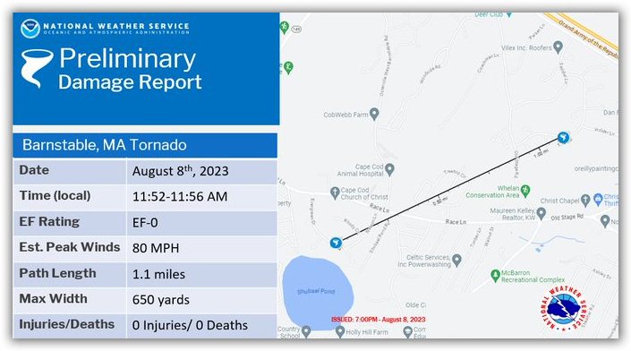
AUG 08, 2023      1152     0      0     F0  Barnstable / near Marstons Mills.

DUKES County (MA)
    DATE          TIME  FATALS  INJS  F-Scale
DEC 18, 1951      1700     0      0     F2  1 NNW Katama Airpark
JUL 13, 1996      1523     0      0     --  Water Spout / Gay Head
OCT 06, 1999      1742     0      0     --  Water Spout / Gay Head
NANTUCKET County (MA)
    DATE          TIME  FATALS  INJS  F-Scale
APR 06, 1982      1334     0      0     --  Funnel Cloud / MA Blizzard
SEP 09, 1998      1550     0      0     --  Funnel Cloud / 9 S of Island
data from NOAA's Storm Prediction Center and from The Tornado Project

 Please read our Legal Notice and our Privacy Statement.
